Halfway up a switchbacked climb, you stop to check your position. The watch on your wrist shows a clean line of the route so far. The phone in your hip belt pocket holds the topographic map you actually want to read. Both work. Neither is perfect. The real question is not which device is better in the abstract, but which one deserves the weight, the battery, and the pocket space on the trails you actually hike.
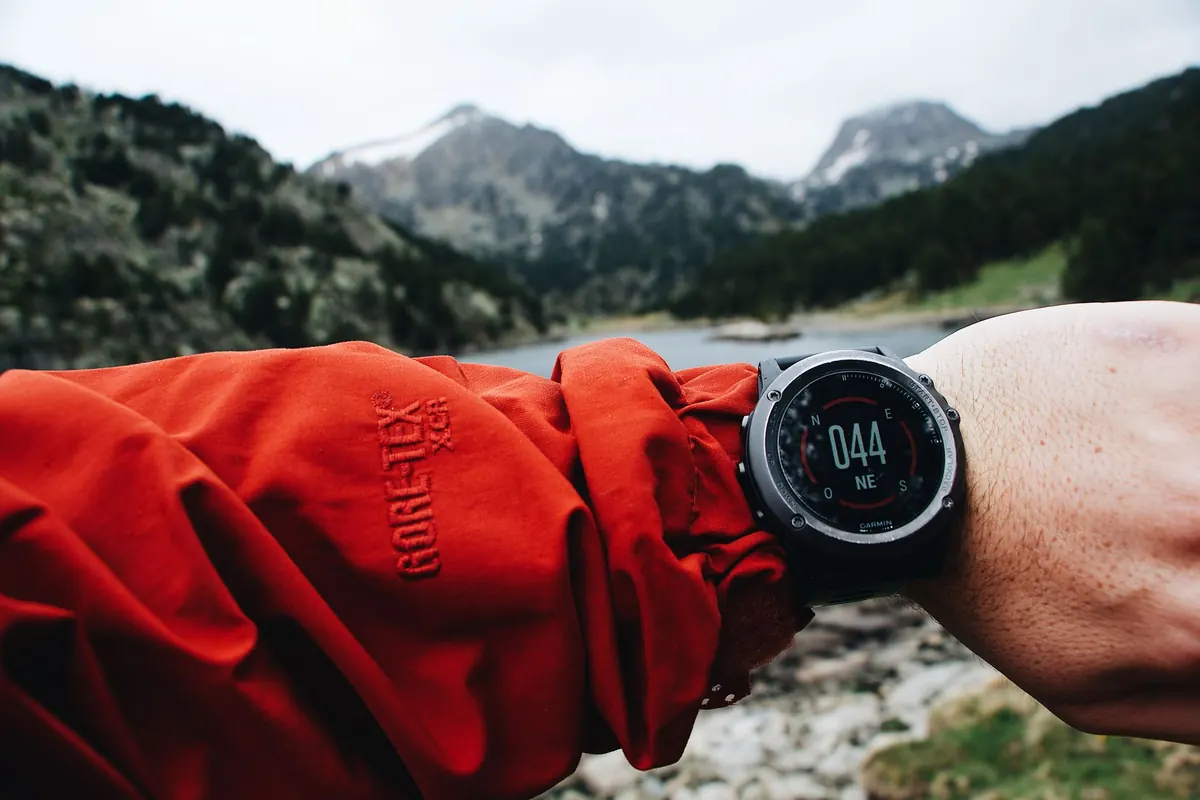
A GPS watch earns its place through immediacy. It lives on your wrist, charged and ready, and hands you distance, pace, elevation gain, and a breadcrumb trail without breaking stride. Off-course alerts and turn prompts are the closest thing to a friend tapping you on the shoulder. You never take off a glove or dig through a pack.
A phone earns its place through detail. The screen is big enough to read contour lines, spot switchbacks, and compare the gully ahead against what the map says should be there. Planning a route, dropping waypoints, and checking satellite imagery are all far easier on a phone.
The trade-offs follow directly. A watch screen is tiny, its maps are often crude or missing entirely, and plotting a route on it is genuinely unpleasant. A phone is fragile, thirsty for power, and wants two hands with dry fingers.
Both devices listen to the same satellites, usually GPS plus GLONASS, Galileo, or BeiDou. Multi-band receivers, once rare, now appear in watches as well as phones, and the old assumption that a phone always wins on accuracy no longer holds. What still matters is antenna placement and sky view.
Phones get one advantage near civilization and lose it in the backcountry: assisted GPS, which borrows cell towers and Wi-Fi networks to grab a fast initial fix. In a canyon with no signal, both devices are working from satellites alone. Expect drift under dense canopy, against cliff walls, and deep in valleys. When you need a clean fix, stop moving, hold the device flat with a clear view of the sky, and wait a few seconds. A watch worn on the inside of the wrist has your arm in the way; rotate it skyward or slip it over your sleeve.
For elevation, a watch with a barometric altimeter is usually steadier than GPS-derived altitude, which wanders. Calibrate that altimeter at a known elevation before a big climb, and recheck it at a mapped summit or lake.
This is where phones still pull ahead, and where most trail frustration begins. A phone with a mapping app can store detailed topo, shaded relief, and sometimes satellite layers for an entire region. A few high-end watches display full topographic maps you can pan and zoom, but most show only a breadcrumb line, a compass arrow, and distance to the next waypoint. On a foggy ridge with three faint trails branching off, a breadcrumb tells you where you have been. A topo map tells you where you should go.
Preparation matters more than hardware. Before any trip, do this:
The screen is what drains a phone, not the GPS chip. A phone recording a track in airplane mode with the display off can idle for days. Flip that screen on and leave a mapping app running, and you can watch a large share of a full charge disappear over a long afternoon. Cold makes it worse, sometimes dramatically, which is why winter hikers keep phones inside a layer instead of in an outer pocket.
Watches vary enormously by model and mode. Watch-only operation can stretch for days or weeks. Full GPS tracking is measured in hours, and adding mapping, music, or multi-band positioning cuts that further. A few habits stretch both devices considerably:
A watch is built for the wrist it sits on. Buttons work through wet gloves, the case shrugs off rock scrapes, and most models handle rain and river crossings without complaint. That reliability in bad conditions is worth more than any feature list.
Phones need help. A case and screen protector are the minimum, and a waterproof pouch helps on river trips. Capacitive touchscreens misbehave with wet fingers, and conductive glove tips get unreliable once soaked. Phones also overheat in direct sun when left on a pack lid, and they crack when dropped on talus. If you use a phone as your primary navigator, treat it like the fragile instrument it is: keep it in a padded pocket, not swinging from your hand.
Carry both, and give each a job. The watch stays on your wrist and handles tracking, distance, elevation, and off-course alerts. The phone stays in a pocket in airplane mode, turned on at junctions, for the detailed map, a photo of the route, and an emergency call if there is signal. A power bank keeps the phone alive for multi-day trips.
Match the device to the trip and your tolerance for risk. Short, well-marked day hikes with plenty of other people around? A phone with a downloaded map is enough, and it is the camera and the emergency line already in your pocket. Long days, winter conditions, off-trail travel, or terrain where a wrong turn has real consequences? A watch plus a phone plus a paper map is the sensible kit, because each covers a different failure mode.
Whatever you carry, learn it before you need it. Practice loading a route, panning to your position, and reading a bearing from the map while sitting at home. Leave your itinerary with someone, carry more battery than you think you need, and treat every device as a convenience rather than a guarantee. The terrain does not care what is on your wrist.
Photo: Maël BALLAND / Pexels